As we approach the second half of 2024, a significant climatic shift is expected from El Niño to La Niña, according to a US government weather forecaster. This transition, characterized by unusually cold temperatures in the Pacific Ocean, could have profound effects across the globe, particularly in the Asia Pacific region.
RELEVANT SUSTAINABLE GOALS
A Quick Flip From El Niño to La Niña Portends Rain in Asia
The La Niña pattern is known for increasing precipitation in areas such as Australia, Southeast Asia, and India, while typically bringing drier conditions to the grain and oilseed-producing regions of the Americas. “Although forecasts made through the spring season tend to be less reliable, there is a historical tendency for La Niña to follow strong El Niño events,” stated the National Weather Service’s Climate Prediction Center (CPC). This cyclical phenomenon influences the trade winds that encircle the equator, crucially impacting global weather patterns.
During a neutral year, these trade winds propel warm water westward, replacing it with cooler ocean water from the depths. El Niño disrupts this pattern by weakening the trade winds, warming the eastern Pacific and altering the jet stream to dry the northern U.S. and Canada while moistening the southern U.S. Conversely, La Niña strengthens these winds, pushing warm water toward Asia and enhancing the upwelling of cold water off the Pacific coast of the Americas, which shifts the jet stream northward, affecting weather across the Southwest, Southeast, Pacific Northwest, and the Great Lakes.
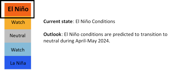
EI Niño/La Niña Status (Updated on 5 April 2024 / source : weather.gov.sg)
The El Niño pattern, active since June 2023, is now waning with an 85% probability of transitioning to neutral conditions before June. A resurgence of La Niña is predicted soon after, with a 60% likelihood between June and August, as reported by the National Centers for Environmental Prediction.
Tom Di Liberto, a climate scientist, noted, “For El Niños of this strength, it’s not uncommon to see a rapid cessation and an equally swift transition to La Niña.” Current ocean measurements indicate warm surface temperatures over a reservoir of colder, sub-surface waters. “Once this cold water reaches the surface, the transition to La Niña will occur swiftly,” Di Liberto explained.
This impending switch heightens the risk for an active hurricane season. During El Niño, elevated ocean temperatures fuel high-altitude winds creating vertical wind shear, which disrupts hurricane formation. “However, La Niña reduces this shear, fostering conditions that can intensify storm activity,” said Alex DesRosiers, a doctoral candidate in atmospheric science.
La Niña Effects on Asia
Globally, the implications extend beyond weather anomalies. India is poised for a normal monsoon, offering relief from extreme heatwaves, while the U.S. Midwest, Delta, and Plains anticipate above-normal rainfall, boosting agricultural yields. Conversely, Southern Africa faces severe drought exacerbated by natural and anthropogenic warming.
In Indonesia, the Meteorology, Climatology, and Geophysics Agency (BMKG) forecasts a post-El Niño La Niña, heightening risks of flooding and cooler daily temperatures, potentially hampering agricultural productivity and disrupting food distribution.
Dwikorita Karnawati, head of BMKG, emphasized the agricultural implications: “La Niña typically results in wetter conditions that increase the likelihood of floods, pest outbreaks, and plant diseases, which could lead to higher food prices due to disrupted supply chains.”
As the world braces for these changes, the economic and societal impacts of this climatic pendulum swing from El Niño to La Niña will be closely monitored.
Lead image courtesy of ePhotocorp from Getty Images
An advertising copywriter and an avid novelist. Currently mastering the art of gardening. Her dream is to build her own permaculture farm for sustainable future in her hometown, Bandung, West Java Indonesia.