

The collaboration has already revealed insights into changing coastal habitats throughout the Caribbean, Indonesia, and Papua New Guinea.
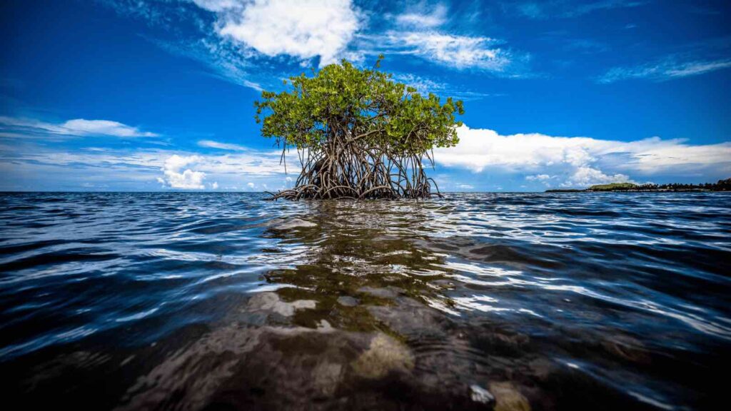
Planet Labs PBC and The Nature Conservancy (TNC) have joined forces to create the Blue Carbon Explorer, a tool that maps mangrove and seagrass blue carbon ecosystems around the world. Blue carbon refers to carbon stored in marine environments, which can store up to five times as much carbon as upland forests. Mangroves alone sequester over 31 million tons of carbon each year, and protecting and restoring these environments is crucial for biodiversity, combating climate change, and supporting communities.
RELEVANT SUSTAINABLE GOALS
The Blue Carbon Explorer
TNC’s Lindsey Smart, Climate and Ocean Scientist, believes “these ecosystems really are a great ocean-climate link, and part of our strategy is to unlock this blue carbon potential for climate mitigation.” The Blue Carbon Explorer leverages data collected from drones and satellite imagery, including Planet’s SkySat and PlanetScope imagery, to visualize the health of these ecosystems and identify areas for restoration and protection.
Valerie Pietsch McNulty, Conservation Scientist for TNC’s Caribbean Division, said, “Planet’s data has been a game-changer for decision-making due to its high resolution because restoration sites can be very small, so having this level of granularity in the spatial data allows us to really target specific areas, within expansive mangrove patches.”
The collaboration has already revealed insights into changing coastal habitats throughout the Caribbean, Indonesia, and Papua New Guinea. Governments can use the maps to account for their natural resources and potential blue carbon stocks, while new techniques in artificial intelligence and lessons learned from the Blue Carbon Explorer can be used to better understand coastal habitats worldwide.
The development process for the Blue Carbon Explorer prioritized the role and needs of local stakeholders. TNC conducted extensive workshops and research with local communities and government leaders to build the tool and apply it to scale-up restoration efforts on the ground.
Steve Schill, Lead Scientist for the Caribbean at TNC, said, “when prioritizing where to restore coastal habitats, it is critical to include the people component and identify areas where climate change is having the most impact.” Evaluating these coastal ecosystems with satellite data can help identify areas where the resilience of a coastal community can be improved, and the benefits of coastal protection and enhanced livelihoods and human well-being are aligned.
Planet's data has been a game-changer for decision-making due to its high resolution because restoration sites can be very small, so having this level of granularity in the spatial data allows us to really target specific areas, within expansive mangrove patches.
Valerie Pietsch McNulty, Conservation Scientist for TNC’s Caribbean Division
Understanding The Blue Carbon
The world’s oceans and coastal ecosystems have been capturing and storing organic carbon, otherwise known as “blue carbon.” These coastal habitats, which make up only 2% of the ocean’s surface, hold an incredible 50% of the carbon in their sediment – an astonishing 75-gigaton carbon sink that’s equivalent to eight years of CO2 emissions from fossil fuels. However, these vital ecosystems are in danger. The Intergovernmental Panel on Climate Change reports that between 25% and 50% of coastal habitats have vanished in the past century. To save these habitats, it’s crucial to secure financing for blue carbon credits, which could provide a lifeline to these endangered ecosystems.
In summary, the Blue Carbon Explorer is a vital tool for advancing a scientifically rigorous, just, and inclusive transition to a more climate-stabilized future. By combining TNC’s expertise with Planet’s breakthrough Earth observation capabilities, the Blue Carbon Explorer makes these benefits visible and accessible to a wide variety of stakeholders.
You may also be interested in :
Charting A Course For A Sustainable Blue Economy : CIIC Challenges 2023