

The La Nina triple dip phenomenon is something to watch out for. Learn how it affects the weather where you live.
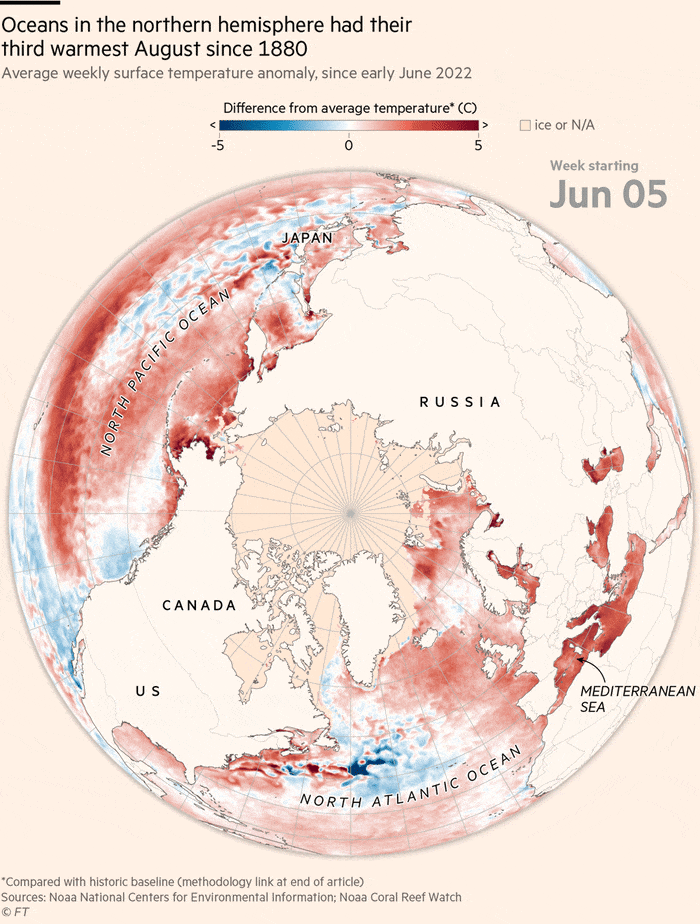
La Niña is back for the third year in a row. The meteorological system over the Pacific Ocean that can influence weather patterns worldwide is projected to continue through the end of the year. La Nina conditions in the tropical Pacific strengthened as trade winds intensified in mid-July to mid-August, affecting temperatures and precipitation patterns and exacerbating drought and flooding in different parts of the world.
RELEVANT SUSTAINABLE GOALS
The La Nina “Triple Dip” Phenomenon
La Niña is back for the third year in a row. La Niña is the cooler than the normal phase of the El Niño Southern Oscillation (ENSO) phenomenon in the central and eastern equatorial Pacific Ocean.
During a La Niña event, the sea surface temperatures over the central and eastern Pacific oceans become cooler than normal. This makes the trade winds and associated storms blowing above them stronger than usual. These strong trade winds and storms cause more rainfall over some regions such as southeast Asia, especially Indonesia and many parts of Australia, but drastically reduce rainfall in other areas such as the Horn of Africa and western United States.
The triple-year La Niña comes at a time when the impacts of global warming are exacerbating ENSO and the phenomenon itself may be affected by a warming atmosphere and oceans.
Global Impacts
Over the past two years, the phenomenon has also contributed to a severe drought in parts of Africa, causing famine in countries including Somalia. Aid agencies have warned that the global energy and food price inflation crises will exacerbate the humanitarian disaster. Climate change continues to drive up global temperatures and contribute to more extreme weather events, including La Niña.
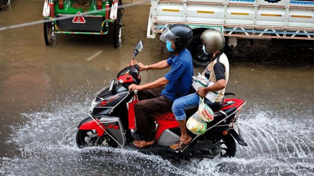
The continuation of the La Niña may also mean an extended southwest monsoon season for India and the rest of south Asia with exceptional episodes of rain and possible floods. In 2021, La Niña contributed to extraordinary rainfall in southern India during the post-monsoon season. In 2022, an active monsoon caused floods in many Indian states, such as Assam, Meghalaya and other northeastern states in June. It has also had detrimental effects on Bangladesh.
Apart from the continued formation of low-pressure areas and depressions due to the warming of the ocean’s surface, the sudden floods in Gujarat in the first two weeks of July and subsequent floods in Rajasthan, Maharashtra, Odisha, Karnataka and Uttar Pradesh have been caused by the La Nia phenomenon. More such floods could be expected in the next two months in the backdrop of an active La Niña.
The incessant monsoon rainfall in Pakistan, which has submerged a third of the country and displaced 33 million people, may also have been affected by an active La Niña. Apart from other local climatic factors and the heatwaves that preceded the monsoon season, the phenomenon might have contributed to the devastating floods.
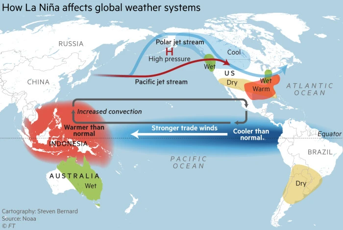
La Niña is the opposite of El Niño, in which the trade winds over the Pacific Ocean weaken and the water off the west coast of the Americas warms up. The WMO El Niño/La Niña Update predicts the continuation of the current La Niña over the next six months, with a 70% chance in September-November 2022 but gradually decreasing to 55% in December-February 2022/2023.
You may also be interested in :
A Degree Of Concern : The Climate Crisis Is On Of Environmental Justice