Mangrove Forest Loss Is Slowing Toward A Halt, New Report Shows

In 2021, the Global Mangrove Alliance, a consortium of NGOs, published “The State of the World’s Mangroves,” the first snapshot study compiled from satellite imagery intended to provide an up-to-date record of global mangrove forest cover. 

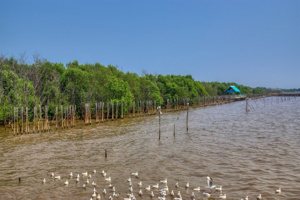
Reposted from Mongabay.com, originally published on 8 November 2022. Photo by Mongabay.

  • In 2021, the Global Mangrove Alliance, a consortium of NGOs, published “The State of the World’s Mangroves,” the first snapshot study compiled from satellite imagery intended to provide an up-to-date record of global mangrove forest cover.
  • The second installment of the report, published in September, draws on improved and updated maps.
  • The report shows a decline in the overall rate of mangrove loss and outlines concrete actions to halt the loss for good and help mangroves begin regaining ground. 

RELEVANT SUSTAINABLE GOALS 
In December 2004, the worst tsunami in recorded history devastated the region encircling the Indian Ocean, killing more than 200,000 people in 14 countries. One year later, researchers showed that mangrove forests confer protection from the sea: They reduced the energy of the tsunami waves, protecting villages near them from major damage.
 
Since then, initiatives to increase mangrove forest cover have proliferated in the context of climate change, not only because these saltwater-tolerant trees protect coastlines, but also because they are incredibly efficient at storing excess atmospheric carbon.
In 2021, the Global Mangrove Alliance (GMA) published “The State of the World’s Mangroves,” its first such snapshot study compiled from satellite imagery intended to provide a reliable, up-to-date record of global mangrove forest cover. Released Sept. 21, GMA’s 2022 report draws on improved maps updated to 2020. Broadly, it highlights advances in tools for mangrove restoration and welcomes a sharp decline in the overall rate of mangrove loss. The authors emphasize that more work is needed, however, and outline concrete actions to halt the loss for good and help mangroves begin regaining ground.
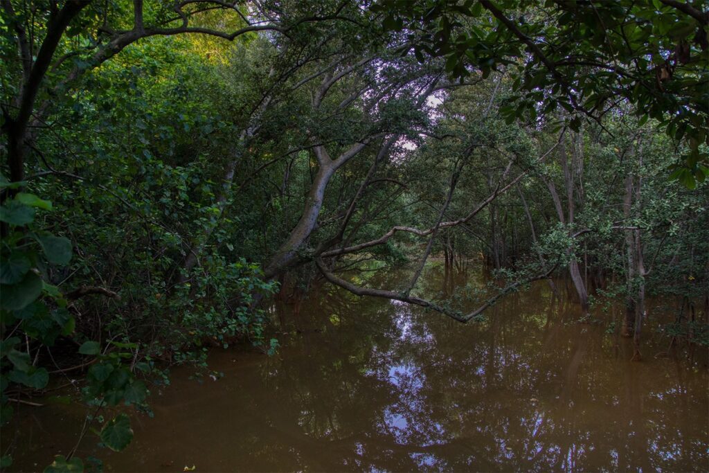
A mangrove thicket in Singapore. Researchers found that mangrove forests confer protection from the sea as they reduced the energy of the tsunami waves, protecting villages near them from major damage. Image by Uwe Schwarzbach via Flickr (CC BY-NC-SA 2.0).

Halting mangrove loss

Since the start of the century, annual global carbon emissions have increased by 50%. As the climate continues to change, mangroves are our “ecosystems of hope,” the report states. The amount of carbon stored in mangrove forests worldwide is equivalent to 22.86 metric gigatons of CO2, according to the report — about half of the carbon emitted globally each year through burning fossil fuels, industrial processes and land-use change.
 
The GMA, a consortium of NGOs launched in 2018, advocates for increasing total global mangrove forest cover. The new report establishes three goals to achieve by the year 2030: avoid the loss of 168 square kilometers (65 square miles) of mangroves; restore half of losses recorded since 1996; and double protection from 40% of mangroves globally to 80%, which means adding 61,000 km2 (23,552 mi2) of protected mangrove cover.
Global Mangrove Watch, GMA’s mapping initiative, reports that the planet’s mangrove cover has decreased by 11,700 km2 (4,517 mi2) since 1996, but, accounting for gains, it estimates the net loss as 5,245 km2 (2,025 mi2), or 3.4%. The greatest losses occurred in Southeast Asia, where 4.8% of mangroves disappeared, and North and Central America and the Caribbean, which lost 4.7%.
 
Human actions have driven this loss: 62% of the total results from land-use changes, particularly for aquaculture and agriculture, according to a 2020 study.  Echoing last year’s report, however, GMA maintains that global mangrove loss is slowing, from a yearly average of 0.21% between 1996 and 2010 to 0.04% between 2010 and 2020.
 
An interesting observation from the mangrove change mapping work is that the rate of decline has dropped right off,” Mark Spalding, an editor of this year’s report and a marine scientist at the NGO The Nature Conservancy, tells Mongabay.
Today, more than 42% of the world’s mangroves are considered protected, with countries such as Brazil, the United States and Bangladesh protecting more than 80% of their mangroves. This represents an increase of 17% since 2012, compared with UNESCO figures. In addition to increased mangrove protections at the national scale, Spalding credits increased “recognition of the value of mangroves” for the reduction in mangrove loss.
 
Still, challenges abound. Most of the world’s mangroves occur in Southeast Asia, where protection rates hover around 20%. Moreover, the pressures on coastal ecosystems there are “enormous,” Nicholas Murray, an author of the report and head of the Global Ecology Lab at James Cook University in Townsville, Australia, tells Mongabay.
 
Our studies show that [Southeast Asia] is a hotspot of the world’s coastal wetlands losses … primarily due to rice and palm oil production,” he says.
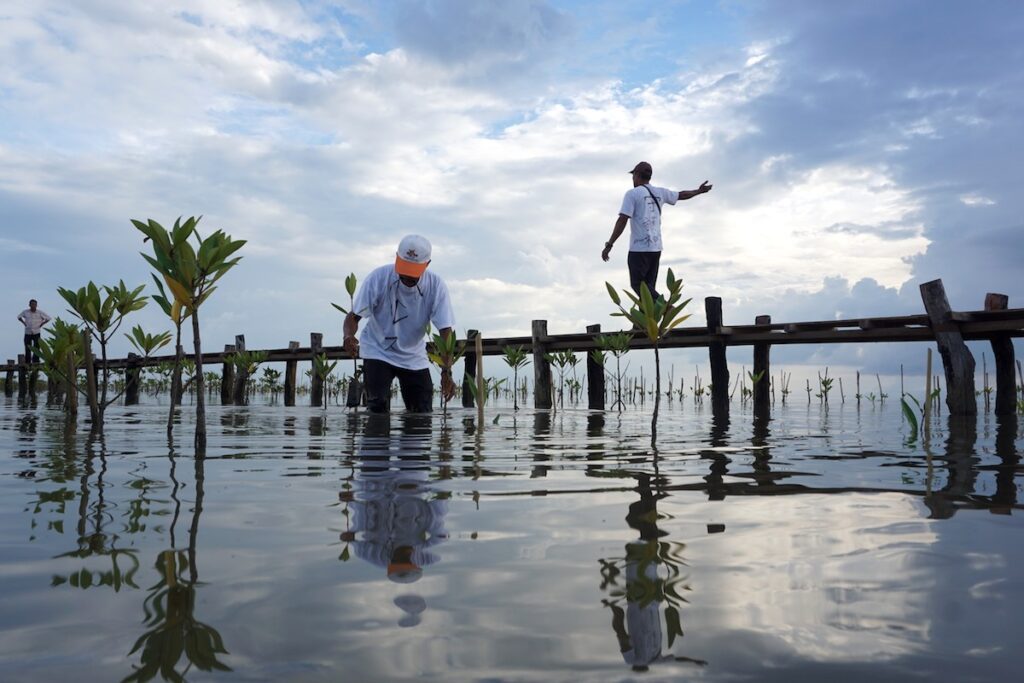
A local volunteer plants a mangrove sapling at the Trapeang Sangke inlet, Cambodia, in 2018. Photo by Matt Blomberg for Mongabay.

Restore the tide to restore the mangroves
Indonesia remains the country with the largest expanse of mangroves: one-fifth of the world’s total, according to the report. It also has the largest potential restoration area, with more than 2,000 km2 (772 mi2) available for restoration of mangrove cover.
 
However, not all mangroves are restorable. “If [the mangrove area] is being used as an aquaculture farm or for a palm oil [plantation], you are not going to be able to restore it,” Murray says.
 
In addition, for a mangrove restoration project to succeed, he says, “you need tidal connectivity to get the tidal cycle working back through those restoration projects.
 
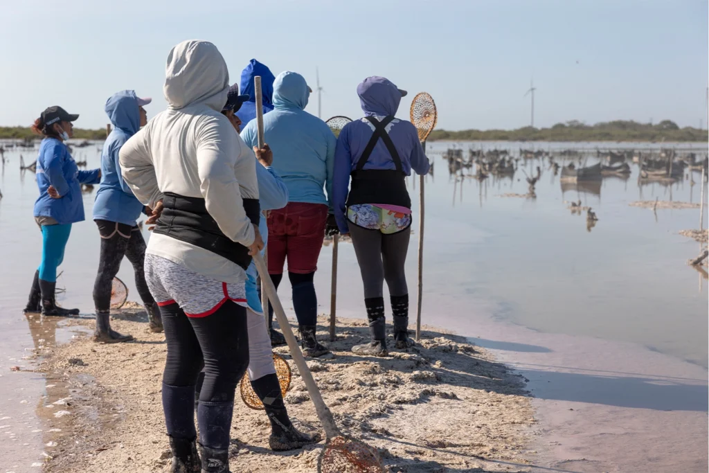
Projects that restore the tidal conditions for natural mangrove growth have seen great success. In Costa Rica, local workers in the Puntarenas Estuary have restored hydrological connectivity to more than 50 km2 (19 mi2) of mangroves by excavating or rehabilitating channels. Similarly, a group of women in Chelem, Mexico, are restoring mangrove cover without planting a single tree by clearing and constructing waterways in deforested areas.
Several Chelemeras, the group of women in Chelem, Mexico, look out on the mangrove nursery before submerging themselves in the lagoon to clear waterways. After inclement weather, they return to the mangrove shelters to repair them. Image by Caitlin Cooper for Mongabay.

The importance of wetlands mapping

The new report calls attention to the interconnectedness of coastal ecosystems and the need to improve mapping for all coastal landscape types.
 
Murray recently led a separate publication of maps and an accompanying study documenting 20 years of change in Earth’s intertidal ecosystems, including mangroves, tidal flats and tidal marshes.
 
We’ve known that tidal wetlands are incredibly dynamic,” he says. “The challenge is that environmental change is occurring from a range of different sources: sea level rise, for example, but human populations in coastal regions are increasing as well.
 
In response, wetlands transition over time, such that the loss of a mangrove forest can translate to the gain of a tidal flat or other ecosystem type. For this reason, efforts to monitor landscape change around mangrove forests are critical to understanding an area’s overall health.
In Mexico, for example, the National Mangrove Monitoring System studies the “buffer” adjacent to mangrove wetlands in order to characterize nearby vegetation and identify the drivers of landscape change. The system uses a metric called the Integral Connectivity Index to evaluate connections between mangrove forests and seagrass meadows and determine potential risks to them from human activity
 
The analysis of these results allows us to identify priority mangrove areas for the maintenance of ecosystem connectivity, as well as the ways [the ecosystems] have changed over time,” María Teresa Rodriguez Zúñiga, a remote sensing specialist with Mexico’s National Commission for the Knowledge and Use of Biodiversity, tells Mongabay.
 
Knowing exactly how people use or impact mangroves and adjacent ecosystems is essential for their conservation, particularly in places where legal protection is weak or nonexistent. In this regard, other effective area-based conservation measures (OECMs) “are at least as good as a protected area,” Spalding says.
 
Sometimes an OECM is an Indigenous reservation or a well-managed fishery. Either way, it has created a sort of no-go area which is equivalent to a conservation area. Those count in our [protection] goals as well,” he says.
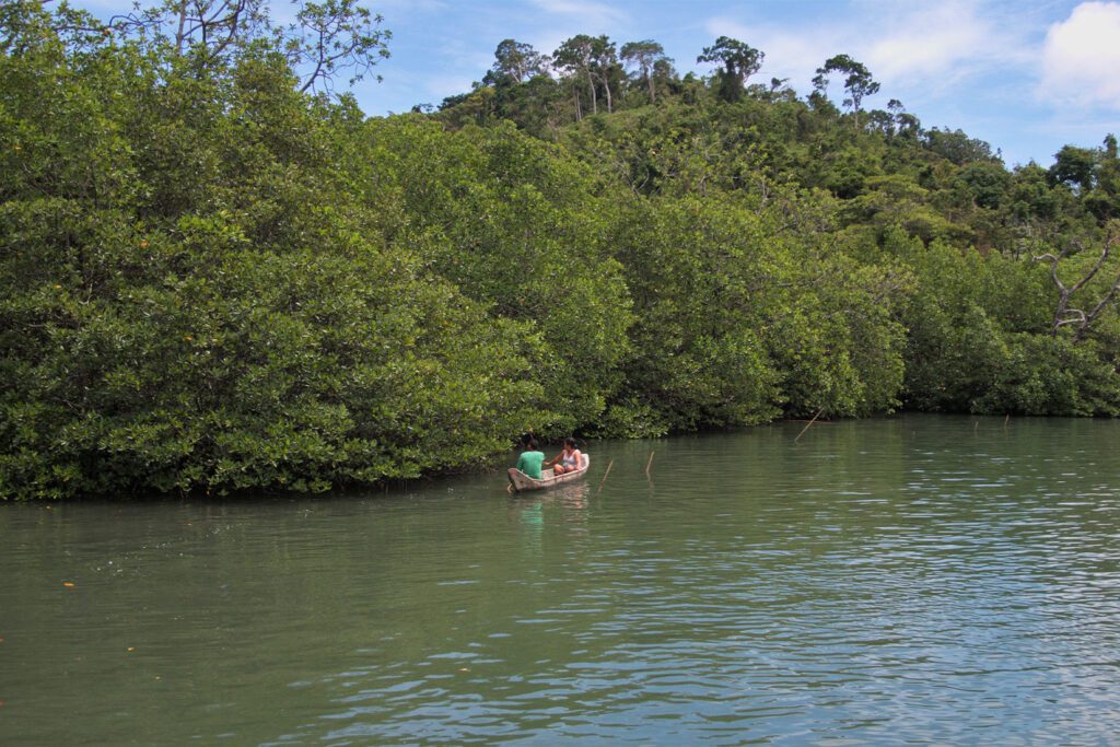
Amid Philippines’ National Greening Program’s conservation efforts, the fishing community in Malampaya Sound, Philippines, recognizes that their bountiful catches are tied to the thick mangroves blanketing the coast. Image by Keith Fabro for Mongabay.

The value of mangrove information sharing

Spalding and Murray both say that while international frameworks and alliances can help set goals, local action is necessary for each member country to achieve its environmental commitments.
 
To encourage this, GMA is developing a Mangrove Restoration Tracking Tool, slated for release in late 2022. Spalding says it will provide a central place for mangrove restorers around the world to record critical information about their projects and to learn from one another about what works and what doesn’t. Toward that end, GMA also plans to release a global guide to mangrove restoration by year’s end.
 
In too many cases, restoration has been done and not much has been recorded, very little has been shared,” Spalding says.
 
There have been so many failures … which have not been scientifically driven,” he adds. “We need to retell the story that it is very much a doable thing to restore mangroves.”
 
Spalding says that satellite data showing mangrove cover is good enough now that scientists can monitor how restoration projects and protected areas are faring and whether governments are meeting their commitments.
 
We’re now feeling pretty strong on the science behind all of this,” he says. “There are huge challenges but [our goals] are achievable.

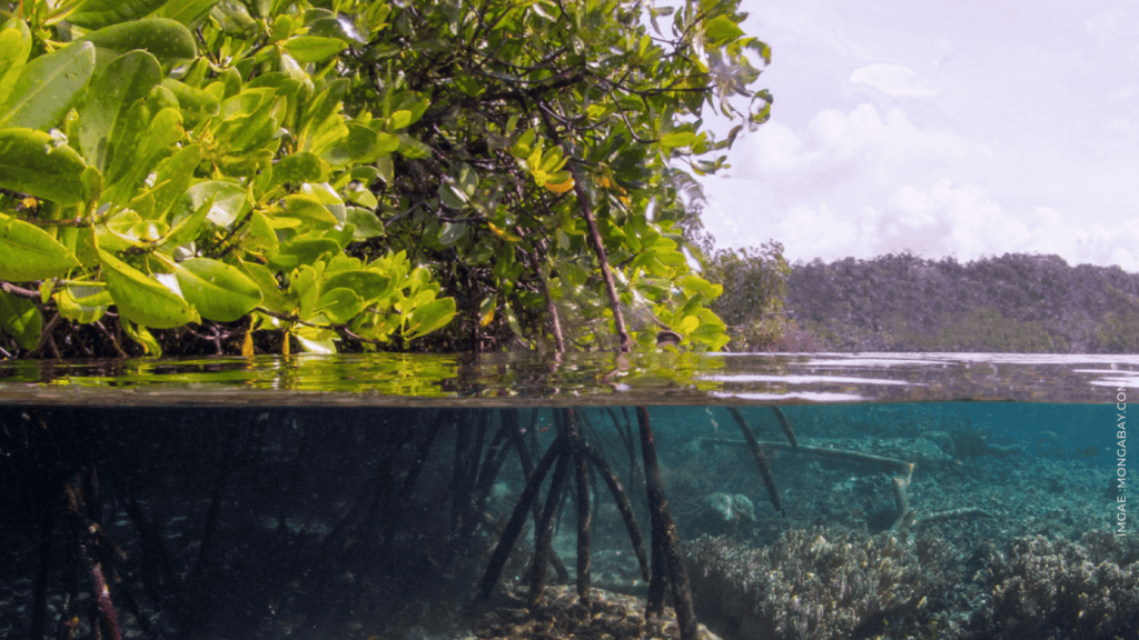
Banner image: Mangroves in Raja Ampat, Indonesia. Image by The Ocean Agency / Ocean Image Bank.

Citations: 

The State of the World’s Mangroves 2022. (2022). Retrieved from Global Mangrove Alliance website: are restoring mangrove cover without planting a single tree

Danielsen, F., Sørensen, M. K., Olwig, M. F., Selvam, V., Parish, F., Burgess, N. D., … Suryadiputra, N. (2005). The Asian tsunami: A protective role for coastal vegetation. Science, 310(5748), 643-643. doi:10.1126/science.1118387

Goldberg, L., Lagomasino, D., Thomas, N., & Fatoyinbo, T. (2020). Global declines in human‐driven mangrove loss. Global Change Biology, 26(10), 5844-5855. doi:10.1111/gcb.15275

Murray, N. J., Worthington, T. A., Bunting, P., Duce, S., Hagger, V., Lovelock, C. E., … Lyons, M. B. (2022). High-resolution mapping of losses and gains of earth’s tidal wetlands. Science, 376(6594), 744-749. doi:10.1126/science.abm9583